Second Sale Date:
Monday, November 30th

More Information
Court Ordered Auction of Real Estate
State of Ohio, Lake County
United States of America Acting
Through the Rural Development,
United States Department of Agriculture (USDA)
vs.
Bernd J. Lecjaks, Jr., et al
Lake County Common Please Court Case # 10CF000488
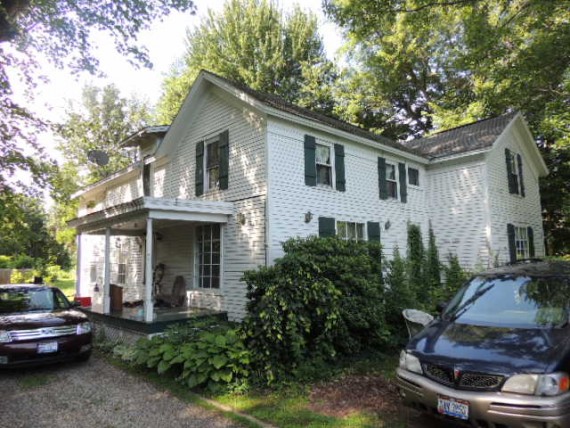
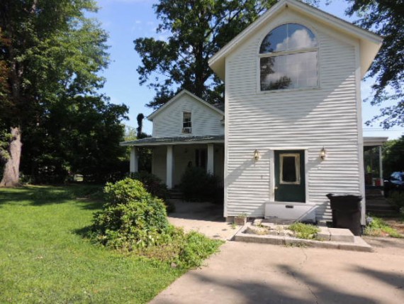
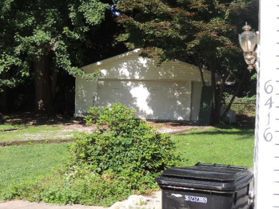
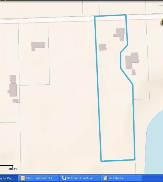
6416 Chapel Road, Madison OH, 44057
Lake County PID 01B1180000160
August 25, 2014 @ 11:00 A.M. on site
The property has been appraised for 64,000.00 and sells witha minimum bid of $42,666.66 + 10% buyer’s premium. Check or cash in the amount of 10% of the sales price is due immediately following the auction which will become your non-refundable deposit if you are the high bidder. This property is being sold as-is with no contingencies. All inspections must be done prior to auction. Close within 30 days of court confirmation, buyer pays all closing costs. Auctioneer’s deed will be given at closing with no liens or delinquent taxes.
LEGAL DESCRIPTION
All that certain lands situated in the Lot 8, Tract 3, in the Township of Madison, Township Number 12 North, Range VI West, in the Connecticut Western Reserve Survey, County of Lake and State of Ohio. A lot line adjustment of the west portion of lands to Keith B. Kinkelaar, as recorded in Document Number 2004R038133 (PPN 01-B-118-0-00-015-0 and PPN 01B-118-0-00-016-0) in the Office of the County Recorder, further described: Beginning at a point to mark the centerline of Chapel Road (50 feet wide) at the northeast corner of lands to R. & L. Satterfield, as recorded in Deed Volume 79, Page 857 (PPN 01B-118-0-00-017-0) said point being located from a 5/8” iron pin found within a monument box assembly “Lake County Engineer” to mark the centerline intersection of Chapel Road with the centerline of Redbird Road (50 feet wide) South 89° 35’ 00” East a distance of 649.85 feet to the point and place of beginning; thence the following (9) courses and distances: South 89° 35’ 00” East with the centerline of Chapel Road, a distance of 123.54 feet to mark a point at the northwest corner of lands to Keith B. Kinkelaar, as recorded in Document Number 2004R038133 (PPN01B-118-0-00-015-0); thence South 00° 45’ 26” West with the new property line (thru a capped 5/8” iron pin set at 30.00 feet) a total distance of 116.48 feet to a capped 5/8” iron pin set to mark an angle point in the new property line; thence South 44° 43’ 27” West with the new property line a distance of 41.72 feet to a capped 5/8” iron pin set to mark an angle point in the new property line; thence South 00° 51’ 43” West with the new property line a distance of 58.66 feet to a capped 5/8” iron pin set to mark an angle point in the new property line; thence South 32° 46’ 47” East with the new property line a distance of 78.55 feet to a capped 5/8” iron pin set to mark an angle point in the new property line; thence South 04° 18’ 32” West with the new property line a distance of 59.41 feet to mark a point at the northwest corner of lands to R. E. Simmons as recorded in Document Number 2000R008714 (PPN 01B-118-0-00-030-0) (said point being referenced by a 3/4” iron pipe found North 80° 32’ 50” East, 2.17 feet from the corner); thence South 00° 21’ 59” West with the west line of said Simmons, a distance of 230.60 feet to a 3/4” iron pipe found to mark a point at the northeast corner of lands to said Satterfield; thence North 89° 27’ 32” West with the north line of said Satterfield a distance of 132.09 feet to a 1/2" iron pipe found to mark an interior corner of said Satterfield; thence North 00° 22’ 57” East with the east line of said Satterfield (thru a 3/4" iron pipe found at 535.50 feet) a total distance of 560.31 feet to the point and place of beginning, said land containing 1.5833 acres (0.9942 acre from PPN 01B-118-0-00-015-0 and 0.5891 acre from PPN 01B-118-0-00-016-0) (with 0.0709 acre contained in the right of way) as surveyed and described in March, 2006 by Timothy E. Stocker, P.S. 7245 Crabbs’ Surveying Order 3970. Basis of bearings are to an assumed meridian along the centerline ofChapel Road, South89° 35’ 00” East. All iron pins set are 5/8” X 30” rebar with cap “Crabbs 7245”, be the same more or less, but subject to all legal highways.
P.P. #01B-118-0-00-016-0
Said property is known as6416 Chapel Road,Madison,OH 44057for street numbering purposes.
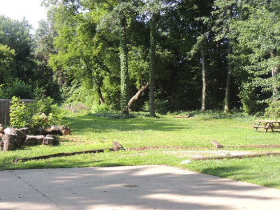
Lot Size: 1.583 Acres
Plaintiff
U.S.D.A
Defendant Name
BERND J. LECJAKS, JR., et al
Attorney
Gilbert L. Rieger
Viewing Dates
No interior viewings. Please do not trespass.
Property Map

Basic Terms:
*This is a Foreclosure Auction ordered by a County Common Pleas Judge. The foreclosure process clears all liens and encumbrances on the subject property.
*The property sells with a minimum opening bid of 2/3 of the appraised value.
*In the case of a tax-lien foreclosure, the opening bid is the aggregate of the tax certificate, interest, court costs and current tax proration.
*The required deposits are as follows:
$2,000 for properties appraised for $10,000 or less.
$5,000 for properties appraised between $10,000 and $200,000.
$10,000 for properties appraised over $200,000.
*If the property is being sold at a physical location, the buyer will immediately write a check for the required deposit. If there are no bids at an on-site auction there will be a second auction between 7-30 days later. The second auction will be offered regardless of price.
*If the property is being sold Online, the successful bidder must wire or directly deposit the required amount into the Chase Bank trust account for Ohio Sheriff Sales within 24 hours of the end of the auction. Credit cards may also be taken for the deposit along with a 3% processing fee.
*The real estate is sold As-Is with no contingencies. All inspections (if available) must be done prior to Auction.
*Close within 30 days of court confirmation.
*No contract is signed after the auction. A one page buyer information form is the only document that is required by the court. See http://www.ohiosheriffsales.com/download_forms for the form.
*A 10% buyer's premium will be added to the high bid to obtain the final selling price.
*Buyer pays all closing costs.
*Private Selling Officer deed or equivalent given at closing with no liens or back taxes.
*The purchaser shall be responsible for those costs, allowances, and taxes that the proceeds of the sale are insufficient to cover.
Realtor Participation:
Realtor showings and cooperation are encouraged if the property is vacant and on lock box. For full compensation instructions, see http://www.ohiosheriffsales.com/realtors Please call Auctioneer to schedule all showings.